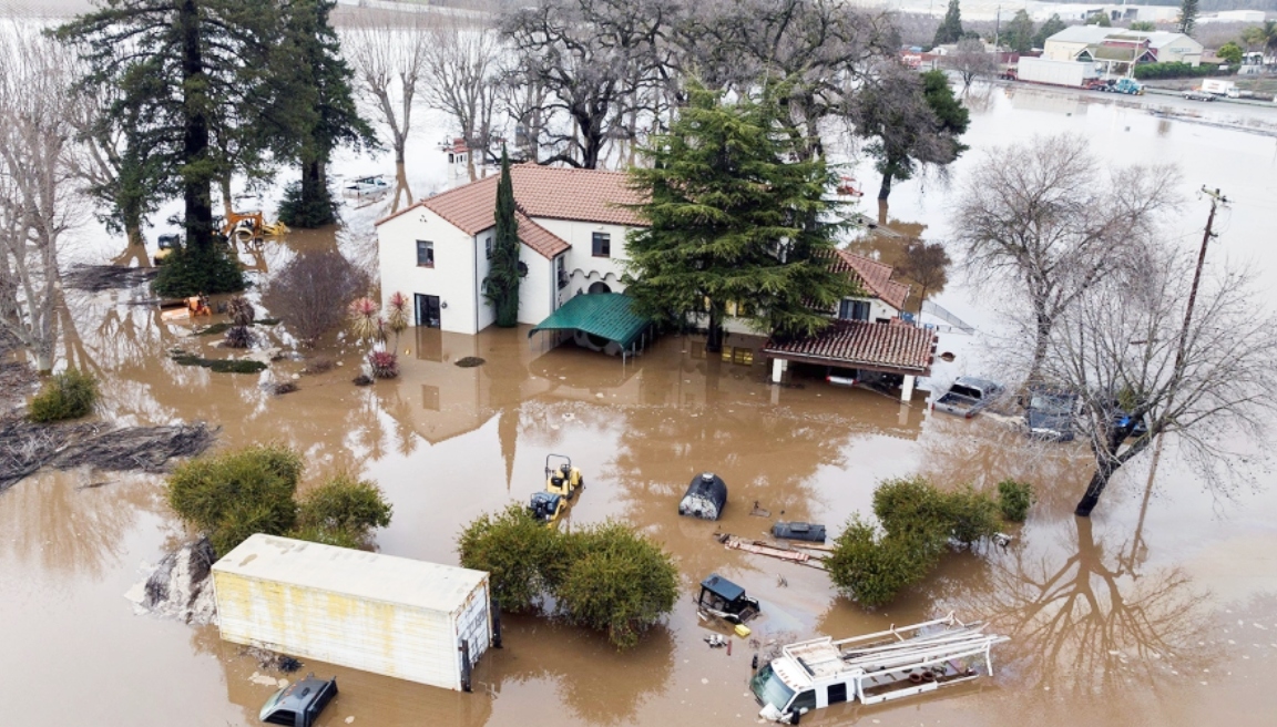
Early Thursday, NOAA declared that El Niño conditions are present and are expected to strengthen through later this winter.
Americans Brace For Bad Weather
For the first time in three years, El Niño is back, according to a statement from the Climate Prediction Center. El Niño-Southern Oscillation (ENSO) can create significant differences in average ocean temperatures and often plays a pivotal role in how global weather patterns unfold.
According to Homeland Security Today, “The expected El Nino has emerged, according to scientists at NOAA’s Climate Prediction Center, a division of the National Weather Service. In the monthly outlook released today, forecasters issued an El Nino Advisory, noting that El Nino conditions are present and are expected to gradually strengthen into the winter.”
The ENSO pattern occurs in three stages. The neutral state indicates that sea surface temperatures in the tropical Pacific are near a long-term historical average. At the same time, La Niña results in ocean temperatures that are cooler than the historical average along with stronger surface winds.
El Niño conditions typically result in a warmer Pacific Northwest, wetter in the south, southwest, and coastal southeast with drier weather in the interior Southeast. Cooler weather is also more likely for the south and southeast.
It could bring fewer developing hurricanes in the Atlantic, but stronger hurricane activity in the Central and Eastern Pacific basin.
The stormy weather will also affect the world’s weather, potentially bringing drought to Australia, more rain to the southern US, and weakening India’s monsoon.

“Depending on its strength, El Niño can cause a range of impacts, such as increasing the risk of heavy rainfall and droughts in certain locations around the world,” Michelle L’Heureux, a climate scientist at the Climate Prediction Center, said.
How The United States May Be Affected
Forecasters said there is an 84% chance the system will be of moderate strength and a 56% chance it will become a strong event at its peak.
“Typically, moderate to strong El Niño conditions during the fall and winter result in wetter-than-average conditions from Southern California to along the Gulf Coast and drier-than-average conditions in the Pacific Northwest and Ohio Valley,” the advisory said. “El Niño winters also bring better chances for warmer-than-average temperatures across the northern tier of the country.”
El Niño weather will continue to increase until winter.
This person noted it might be cooler in Texas this year because of the different weather conditions.
What Is El Niño?
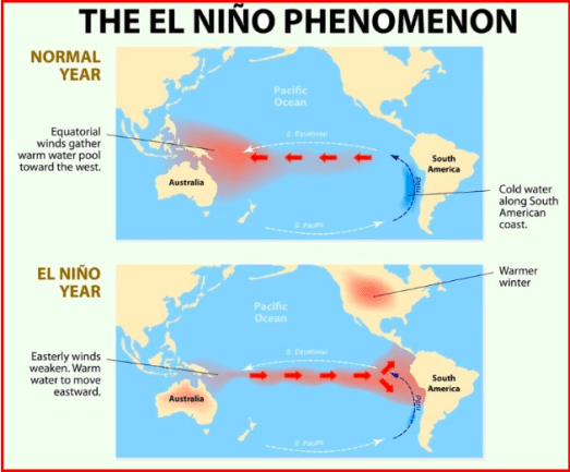
El Niño is a climate pattern that starts with warm water building up in the tropical Pacific west of South America.
This happens every three to seven years or so. It might last a few months or a couple of years.
According to Ocean Service-NOAA, “During El Niño, trade winds weaken. Warm water is pushed back east, toward the west coast of the Americas. El Niño can affect our weather significantly. The warmer waters cause the Pacific jet stream to move south of its neutral position. With this shift, areas in the northern U.S. and Canada are dryer and warmer than usual. But in the U.S. Gulf Coast and Southeast, these periods are wetter than usual and have increased flooding.”
According to NOAA, here’s a visual explanation of how El Niño could affect the United States.
How did El Nino get its name?
The phenomenon became known as El Niño because it occurred around Christmas. El Niño is Spanish for “the boy child.”
What are the negative effects of El Nino?
Severe drought and associated food insecurity, flooding, rains, and the temperature rise due to El Niño are causing a wide range of health problems, including disease outbreaks, malnutrition, heat stress, and respiratory diseases.
Another natural phenomenon similar to El Nino is La Nina. The term La Nina means ‘ little girl.’ It is the opposite of El Nino’s phenomenon as it results in the ‘cooling’ of the ocean water in parts of the Pacific Ocean.
Get the news you need at It’s On News.


